

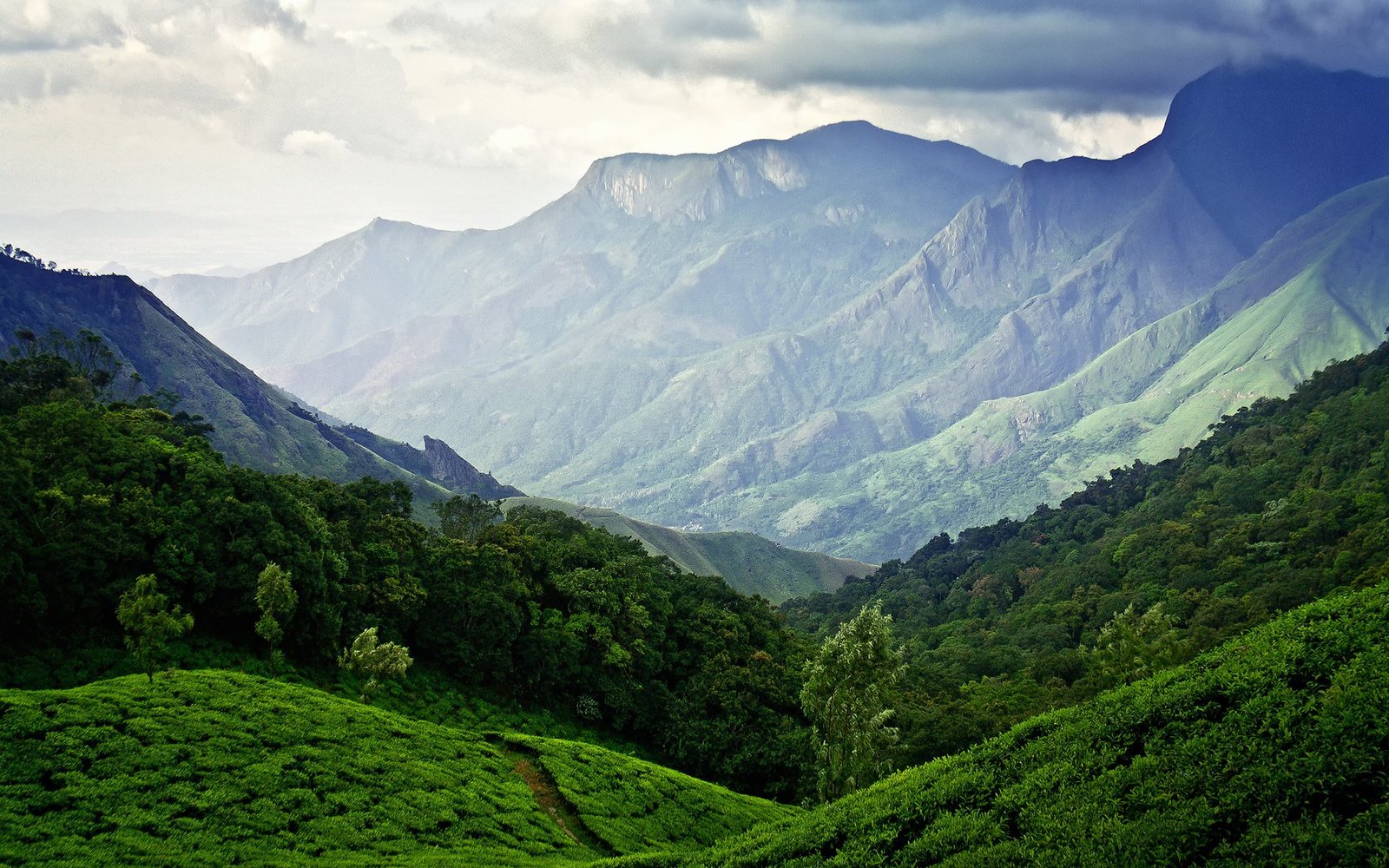
The Char Dham Yatra in Uttarakhand stands among the most sacred pilgrimage journeys in India, guiding devotees through the divine Himalayan shrines of Yamunotri, Gangotri, Kedarnath, and Badrinath. Each temple is located deep within the Garhwal Himalayas, surrounded by dramatic terrain, steep valleys, cold rivers, and shifting mountain weather. Because of these geographical challenges, having a clear understanding of the complete Char Dham Yatra route map is essential for pilgrims traveling by road, especially those planning their journey independently or reviewing various chardham yatra packages for structured assistance. With thoughtfully planned routes, reliable road connections, and updated guidance, travelers can complete the yatra safely, comfortably, and with greater confidence.
Understanding the Char Dham Circuit
The Char Dham pilgrimage follows a clockwise circuit starting from Yamunotri, moving to Gangotri, then Kedarnath, and finally Badrinath. This is known as the traditional route flow and has been followed for generations because it aligns with auspicious travel directions believed to bring blessings and fulfill spiritual intentions.
The Four Dhams Include:
Yamunotri Dham – Source of River Yamuna
Gangotri Dham – Origin of River Ganga
Kedarnath Dham – A revered Jyotirlinga temple dedicated to Lord Shiva
Badrinath Dham – Sacred shrine of Lord Vishnu
These locations are not only significant from a religious perspective but also form some of the most scenic and remote mountain regions of northern India, demanding a careful travel plan.
Char Dham Yatra Route Map Overview
While the Yatra can begin from various major cities, the most common starting point is Delhi, followed by Haridwar, Rishikesh, or Dehradun. All these cities act as gateways to the Garhwal Himalayas.
Most Popular Route Flow
Delhi → Haridwar → Barkot → Yamunotri → Uttarkashi → Gangotri → Guptkashi → Kedarnath → Joshimath → Badrinath → Rudraprayag → Rishikesh → Delhi
Travelers can break down the journey into manageable stretches, especially when traveling by road. Each segment involves specific terrain types, elevation gain, and driving hours.
1. Delhi / Haridwar / Rishikesh – The Gateway to the Yatra
Most pilgrims begin their journey from:
Delhi (0 km)
Haridwar (230 km from Delhi)
Rishikesh (250 km from Delhi)
These are well-connected cities with rail, road, and air transport options. Devotees often spend a night in Haridwar or Rishikesh to adjust to the travel pace and gather essentials before entering the mountains.
Recommended halt:
Haridwar or Rishikesh for one night
Why:
Better acclimatization and rest before mountain driving.
2. Haridwar / Rishikesh to Yamunotri Route Guide
Route:
Haridwar → Rishikesh → Dehradun → Mussoorie → Yamuna Bridge → Barkot → Janki Chatti
Approx Distance: 220–240 km
Drive Time: 7–9 hours
After Barkot, roads become narrower and more winding. Pilgrims must reach Janki Chatti, which serves as the base for the Yamunotri trek.
From Janki Chatti to Yamunotri
Trek Distance: 5 km
Options: Trek, Pony, or Palki
The pathway is paved but steep, with mountain views, waterfalls, and forested cliffs.
Important Tips Before Trek:
Start early in the morning
Carry warm clothing even in summer
Keep water, glucose, and light snacks
Avoid trekking after 4 pm due to low visibility
3. Yamunotri to Uttarkashi – Road Conditions and Guide
After completing Yamunotri, the next destination is Uttarkashi, which serves as the base town for the journey toward Gangotri.
Route:
Barkot → Radi → Uttarkashi
Distance: 80–100 km
Driving Time: 3–4 hours
Uttarkashi is a well-developed spiritual town with markets, ATMs, medical facilities, and comfortable accommodations.
Recommended Halt:
1-night stay in Uttarkashi
Why:
Allows rest before the long drive to Gangotri the next day.
4. Uttarkashi to Gangotri Route Map
Route:
Uttarkashi → Harshil → Bhaironghati → Gangotri
Distance: 95–100 km
Driving Time: 3–4 hours
This is one of the most scenic stretches of the Char Dham journey. Pilgrims travel alongside River Bhagirathi while passing through dense deodar forests and cliffside roads.
Places on the Way:
Harshil Valley – Known for lush landscapes and peaceful atmosphere
Bhaironghati – Deep gorge offering dramatic Himalayan views
The Gangotri temple is located at an altitude of around 3,100 meters.
Important Travel Pointers:
Roads are in better condition compared to Yamunotri
Weather can drop rapidly; warm layers are essential
Walking 200–300 meters is required from the parking area to the temple
5. Gangotri to Guptkashi / Sitapur
After visiting Gangotri, pilgrims head toward Kedarnath. Guptkashi or Sitapur generally serves as the base point for Kedarnath.
Route:
Gangotri → Uttarkashi → Ghansali → Guptkashi / Sitapur
Distance: 230–280 km
Driving Time: 8–10 hours
The drive is long but incredibly picturesque, showcasing winding mountain roads and deep valleys.
Why Guptkashi is the Key Base:
Access to Kedarnath helipads
Parking availability
Good accommodation options
Recommended Halt:
1-night stay before starting the Kedarnath trek or helicopter journey.
6. Guptkashi to Gaurikund – Route Summary
Route:
Guptkashi → Sonprayag → Gaurikund
Distance: 30–35 km
Drive Time: 1–2 hours
Sonprayag acts as a vehicle drop point. Only local shuttle vehicles are allowed to reach Gaurikund.
Kedarnath Trek Details:
Trek Distance: 16–18 km
Options: Trek, Pony, Palki
The Kedarnath route is physically demanding with steep ascents.
Travel Advice for Kedarnath Trek:
Begin early morning (3–5 am)
Stay hydrated
Keep woolens, rainwear, flashlight
Trek only at a steady pace
Avoid overexertion at high altitude
Note: Pilgrims can also choose helicopter services from various helipads such as Phata, Sersi, or Guptkashi.
7. Kedarnath to Badrinath – Detailed Guide
After Kedarnath darshan, pilgrims travel toward Badrinath, the final and highly revered Dham.
Route:
Guptkashi → Chopta → Joshimath → Badrinath
Distance: 210–230 km
Travel Time: 7–9 hours
The road toward Chopta, also called the “Mini Switzerland of India,” is extremely scenic. Joshimath serves as a key base town offering hotels, restaurants, and the ropeway to Auli.
Badrinath Temple Altitude:
Approx. 3,300 meters
At Badrinath, Pilgrims Visit:
Mana Village
Vyas Gufa
Saraswati River
Ganesh Gufa
Bheem Pul
These locations add cultural and natural richness to the pilgrimage.
8. Badrinath to Rishikesh / Haridwar – Route & Road Notes
Route:
Badrinath → Joshimath → Karnaprayag → Rudraprayag → Devprayag → Rishikesh → Haridwar → Delhi
Distance to Rishikesh: 295–310 km
Drive Time: 9–11 hours
The return journey follows the Alaknanda River and descends gradually through the lower Himalayan towns.
Most pilgrims conclude the yatra here, though some continue to Delhi or Dehradun for flights or trains.
Road Conditions Through the Char Dham Circuit
The region experiences significant weather changes, landslides, rainfall, and melting snow, which influence road conditions.
General Road Condition Overview:
Delhi to Rishikesh: Excellent highways
Rishikesh to Barkot: Mostly good, some narrow patches
Barkot to Janki Chatti: Narrow, winding roads
Uttarkashi to Gangotri: Well-maintained but cliffside roads
Guptkashi to Gaurikund: Steep, narrow sections
Joshimath to Badrinath: Managed by the Border Roads Organisation (BRO), seasonal closures possible
During peak season, traffic restrictions, time-bound movement, and regulated passes may apply.
Best Time to Travel the Char Dham Route
The Char Dham temples open between April/May and close around October/November. The best travel months depend on the traveler's preference.
April to June (Summer Season)
Most popular time
Pleasant weather
Clear roads
Easy trekking conditions
July to September (Monsoon Season)
Heavy rainfall
Risk of landslides
Travel advisories must be checked regularly
Suitable only for experienced mountain travelers
September to Early November (Post-Monsoon / Pre-Winter)
Very scenic season
Cold weather, but stable roads
Recommended for peaceful travel
Winter (Nov–April)
Temples closed
Roads blocked by snowfall
Essential Travel Tips for Char Dham Route
1. Know Altitude Levels
Each Dham is at a different elevation. Understanding altitude gain helps prevent discomfort.
2. Register Before Travel
Mandatory biometric registration ensures safe tracking and emergency assistance.
3. Maintain Slow and Steady Travel
Avoid rushing through the circuit. Mountain driving requires patience.
4. Pack for All Weather Conditions
Even in summer, temperatures can drop drastically at night.
5. Keep Cash in Smaller Denominations
Remote routes may not have consistent digital connectivity.
6. Carry Medical Essentials
Basic personal medicines, altitude-related tablets, ORS, and pain relief balms are important.
7. Check Daily Weather and Road Updates
Roadblocks due to landslides may require flexible planning.
Why Understanding the Route Map Matters
The Char Dham Yatra is not just a religious journey—it is also a demanding mountain expedition requiring awareness, preparation, and clarity. A well-understood route helps pilgrims:
Plan halts efficiently
Understand driving distances
Choose suitable transport options
Anticipate weather conditions
Stay safe on the remote mountain road

 Enquiry